Drone-based LiDAR mapping that delivers survey-grade data in days — not weeks.

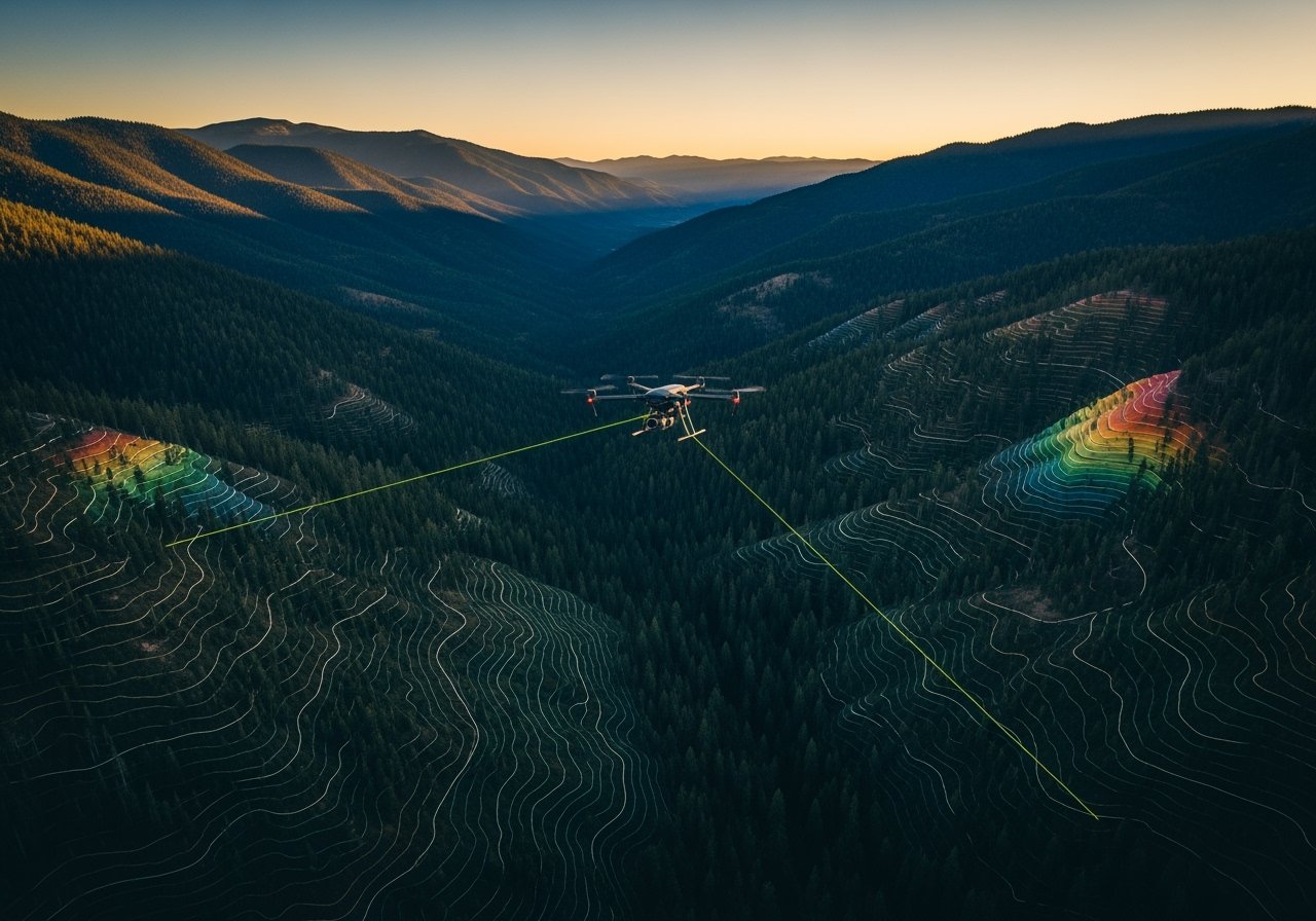
Perfect for grading, earthwork, and topo planning — and fast delivery with our advanced RTK drone LiDAR system.
![[digital project] image of website interface on a laptop screen for a consulting firm.](https://cdn.prod.website-files.com/6883d02762a9ad7e401ca44b/68846f367d8dbf98a2d0415d_PtWNjupe5RYLSzMvDLQbL_output_00001.jpg)
Aerial LiDAR Mapping · Terrain & Elevation Models · Progress Tracking · Roof & Site Scans · Parcel Mapping · Infrastructure Surveys
![[background image] image of construction team meeting (for a construction company)](https://cdn.prod.website-files.com/6883d02762a9ad7e401ca44b/68846f374a8c450cc9181723_pvQ0ZAN-C0g0GoNKxhJ9m_output_00001.jpg)
Turnaround times drop from weeks to days — giving you the data you need, when you need it.
Ready to capture high-resolution, survey-grade aerial data? Let’s get your project mapped with precision.
Book a CallGet clear, technical answers to common questions about drone LiDAR scanning, data accuracy, deliverables, and our service area. Designed for land developers, engineers, and construction professionals.
Contact usDrone LiDAR uses airborne laser pulses to generate dense 3D point clouds of terrain, structures, and vegetation. This enables precise topographic mapping for surveying, engineering, and planning applications.
Our LiDAR delivers vertical accuracy within ±5cm, meeting industry standards for civil engineering and land development. All datasets are processed and quality-checked before delivery.
We provide point clouds, digital surface and terrain models (DSM/DTM), orthomosaics, and GIS-ready files (LAS, DXF, SHP, GeoTIFF). Formats are tailored for CAD and GIS compatibility.
We serve all of Utah and select nearby states. Our team deploys quickly to urban, rural, and remote sites across the Western U.S. for projects of any size.
Request consultations, technical guidance, or service details. Our team delivers prompt, accurate answers for all project inquiries.